The Tug GENERAL
History
The Tug GENERAL was built in 1900 at West Bay City, MI, by James Davidson for the Union Towing and Wrecking Company of Duluth, MN, which was owned and managed by the Great Lakes Towing Company of Cleveland, Ohio. Her dimensions were: length, 97.5 feet; beam, 24 feet; hull depth, 10 feet; and gross tonnage, 132 tons. From 1900 to 1910, the vessel was engaged in the towing and wrecking business on the upper lakes with much of that time being spent working the St. Marys River, where vessel groundings and other types of accidents were quite frequent.
On November 30, 1910, the tug GENERAL was sunk in a collision with the large Canadian Pacific Steamer ATHABASCA near Lime Island, a few miles above DeTour. Three lives were lost in this accident. The vessel remained on the bottom of the St. Marys River until 1919, when T. L. Durocher of DeTour, MI, raised the GENERAL and put her back into service. For approximately 10 years, the vessel served in Mr. Durocher’s fleet in support of his salvage, dock and dredge business. Finally, on April 7, 1930, the GENERAL caught fire while docked at DeTour and burned to the waterline. The vessel’s machinery was salvaged and the hull was allowed to sink near Frying Pan Island where it remains to this day.
Wreck Description:
Much of the hull and some portions of one of the cabins are intact and many small artifacts are present. The engine, boiler and other major machinery has been salvaged. Near the stern is a very large steering quadrant that was connected by chains to the vessel’s steering wheel and used to steer the vessel. The General is an interesting dive.
Because this wreck is well north of the entrance to DeTour passage and very close to shore, it is generally protected from wave action and is diveable in almost all weather conditions. This makes it an excellent “back-up” dive site, when the seas are too rough to allow diving on the open lake (Lake Huron).
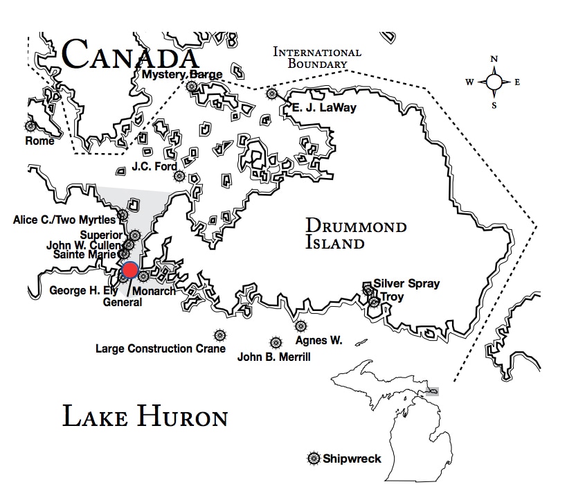
Wreck Location: The wreck lies in 15-25 feet of water just off the northwesterly shoreline of Frying Pan Island. Because the shore of island drops off steeply in this area, the wreck is extremely close to the island. The Lat/Long coordinates are:
Lat/Long Coordinates:
Latitude:45º 59.232’ North
Longitude:83º 53.832’ West
Depth: The wreck lies in 15-25 feet of water.
|
Map courtesy of Michigan Underwater Preserve Council.
|
© 2009 Mike Spears and the Drummond Island Tourism Association


