Barge SAINTE MARIE
History
The wood car ferry SAINTE MARIE was built at Wyandotte, MI in 1893 by the Detroit Dry Dock Co. for the Mackinac Transportation Co. Her dimensions were: length, 288 feet; beam, 53 feet; hull depth, 19.6 feet; and gross tonnage, 1357 tons. She was used as a passenger and rail car ferry, running between Mackinaw City and St. Ignace from 1893 until 1912. In 1913, she was replaced by a new steel car ferry of the same name.
It may be appropriate, at this point, to remind the reader that prior to 1957, the Mackinac Bridge did not exist and all travel across the straits of Mackinac was done by ferry boats.] After being retired from service by the Mackinac Transportaion Co., the vessel was purchased by T. L. Durocher of DeTour, MI and cut down for use as a barge as part of Mr. Durocher’s salvage, dock and dredge business. When the Sainte Marie’s useful life as a barge was over (circa 1927), Mr. Durocher abandoned the vessel alongside his property in DeTour Village, where it remains to this day.
Wreck Description:
The SAINTE MARIE wreck is one of the more prominent features of the DeTour shoreline. One who is traveling along the western shore of DeTour passage within the limits of DeTour Village will find it nearly impossible to avoid seeing this wreck, which projects several feet above the waterline. Many DeTour citizens view it as the community’s “ultimate eyesore.” This wreck is of little interest to divers, as only a small portion of it lies below the surface. In fact, it is advisable to avoid getting too close to this wreck, due to its age and condition. The deteriorating wreckage is a potential hazard.
Wreck Location:
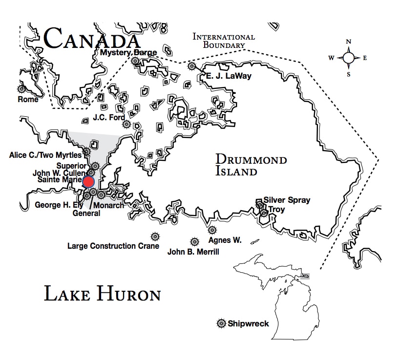
The wreck lies in 0 to 10 feet of water south of DeTour and approximately 700 feet north of Frying Pan Island. Much of the wreck can be seen above the surface. It is accessible from shore at a nearby park in DeTour. Lat/Long Coordinates are:
Lat/Long Coordinates:
Latitude:45º 59.351’ North
Longitude:83º 53.792’ West
Depth: The wreck lies in 0 to 10 feet of water.
|
Map courtesy of Michigan Underwater Preserve Council.
|
© 2009 Mike Spears and the Drummond Island Tourism Association


