Steamer John W. Cullen
|
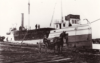
Photo courtesy of the Milwaukee Public Library.
|
History
The steamer JOHN W. CULLEN was built at Milwaukee, WI in 1883, by the Milwaukee Shipyard Co. She was launched as the steamer GEORGE C. MARKHAM and was initially owned by the famous Fitzgerald family of Milwaukee, who employed the vessel as a lumber carrier. Her dimensions were: length, 141 feet; beam, 28 feet; hull depth, 10.4 feet; and gross tonnage, 309 tons. In 1899, she was sold to Thomas Munroe of Muskegon, MI and continued her service of carrying lumber. In 1914, the GEORGE C. MARKHAM was sold to George A. Douglas of Detroit, MI and converted to a sand dredge. In 1917, the vessel was again sold to Cadillac Builders Supply in Detroit. In 1923, she was given her final name of JOHN W. CULLEN. After one or two more changes of ownership, the Cullen ended up sunk near Frying Pan island at Detour, MI and was purchased by T. L. Durocher of DeTour, who seemingly intended to raise the vessel and put it back into service. Apparently the John W. Cullen was never raised and to this day remains sunk approximately 600 feet north of Frying Pan Island and a few feet south of the Sainte Marie wreck. |
Wreck Description:
The wreckage begins in between 5 and 10 feet of water, just south of the Sainte Marie wreck. The hull is largely intact. All of the machinery (boiler, engine, sand dredging equipment) has been salvaged. Only the hull and a few small artifacts remain at the site. Divers will find this an interesting wreck to explore.
Because this wreck is well north of the entrance to DeTour passage and very close to shore, it is generally protected from wave action and is diveable in almost all weather conditions. This makes it an excellent “back-up” dive site, when the seas are too rough to allow diving on the open lake (Lake Huron).
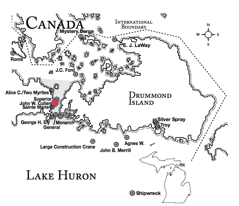
Wreck Location: The wreck lies in 5 to 40 feet of water, just south of the Sainte Marie wreck, south of DeTour and approximately 600 feet north of Frying Pan Island. It is accessible from shore at a nearby park in DeTour. Lat/Long Coordinates are:
Lat/Long Coordinates:
Latitude:45º 59.351’ North
Longitude:83º 53.792’ West
Depth: The wreck lies in 5 to 40 feet of water.
|
Map courtesy of Michigan Underwater Preserve Council.
|
© 2009 Mike Spears and the Drummond Island Tourism Association


